
Where We Work
See our interactive map

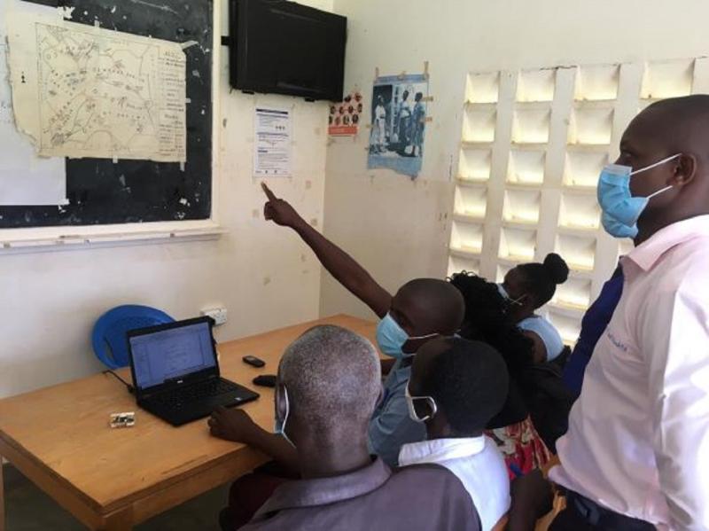
Health facility teams working on GIS maps together. Photo by Irene Mirembe for IntraHealth International.
How Smart Paper Technology and GIS Mapping are strengthening health services in eastern districts.
We know that digital resources contribute to better quality, accessibility, and sustainability of health services and health outcomes. They’re a cornerstone of high-quality health care.
In Uganda, IntraHealth International’s Regional Health Integration to Enhance Services in Eastern Uganda (RHITES-E) Activity fosters an environment that allows for new digital tools and innovations across the eastern region of the country. Over the past two years, the project has rolled out two digital technologies that have improved health services in the region, especially during COVID-19. We’ve learned just how important they are for health workers and the communities they work in.
When the Uganda Ministry of Health started to conduct COVID-19 vaccination drives, data began to accumulate. IntraHealth’s RHITES-E Activity was helping 16 districts in the eastern region of Uganda prepare for and manage these COVID-19 vaccination drives when it became clear that there was a large data backlog and local districts had to migrate from paper-based registers to digital platforms.
So RHITES-E introduced Smart Paper Technology (SPT) and trained 134 district team members on how to use it. SPT is a digital system that uses paper designed with scannable elements that can be uploaded to national databases in real time. The Bukwo District was one of the first to start using this new technology in the region. They faced challenges at the beginning, including slow retrieval of SPT forms, incorrect filling of the SPT forms, and inappropriate SPT form handing. This led to slow real-time data reporting.
But, with training and mentorships, the Bukwo District innovated quickly and started data quality checks, verification, and cleaning before scanning and uploading the vaccination forms onto the SPT sever. They also helped facilitate data entry, deployed skilled data clerks, introduced data bootcamps, and set daily targets to clear the vaccination data backlog using SPT.
This innovation minimized errors and the Bukwo District saw an immediate reduction in data backlog from 28,899 files in March 2022 to 2,285 in May 2022, a 92% decrease. By August 2022, the backlog in Bukwo District was at zero.
SPT creates more efficient, accurate data capture and helps health workers and leaders.
Not only has SPT helped capture, monitor, and analyze data, but it has reduced the cost associated with manual data entry, cleared data backlogs, and improved real-time access to accurate data. This means more efficient, accurate data capture and helps health workers and leaders quickly make decisions, plan logistics, and implement targeted interventions.
While SPT greatly improves data for health care, geographic information system (GIS) mapping improves people’s access to high-quality health services in the region.
GIS technologies use catchment maps and spatial information to improve program monitoring and reporting. In collaboration with the district health teams, RHITES-E helps health facility teams generate GIS-enhanced maps of health facilities and their catchment areas using digital software and provides technical assistance to districts and local partners to help health teams. They take physical drawings of the maps and transform them into digital formats while also transferring them onto reusable and heavy-duty material to carry with them, which helps health workers locate the most at-risk communities.
With RHITES-E’s support, health workers and local leaders can now use GIS technology to:
The Kagaware Health Center III, for example, helped create clear visualizations of the different static and nonstatic outreach posts (such as trading centers, and primary, nursery, and secondary schools) in the health facility catchment area.
"Since the introduction of GIS, our programming improved because we’re using clear maps."
“We had a previous map that we drew on a manila paper,” says Ayalo Anna Florence, a health information assistant at Kagawara Health Center III. “It was drawn every 3 to 4 months with inaccurate features, which was very challenging. Since the introduction of GIS, our programming improved because we’re using clear maps. We can now identify schools around the community, and that’s where we go to provide immunizations.”
GIS spatial data was particularly instrumental for the distribution of infection prevention and control supplies during COVID-19. Deliveries of hand sanitizer, medical masks, handwashing facilities, oxygen cylinders, and isolation tents for hospitals were made much easier with correct maps. Updated maps also helped RHITES-E procure and distribute 20,156 standard operating procedures and guidelines for COVID-19 identification, testing, case management, and prevention, and 5,872 standard operating procedures on infection prevention and control to communities.
Simple but accurate maps documenting interventions also help health workers visualize vaccine uptake, avoid duplicating interventions, monitor coverage, and use resources more effectively.
GIS maps now cover 40% of high-volume sites in the 30 RHITES-E districts (up from 15%) and 55 high-volume sites in the RHITES-E region use GIS technology to map COVID-19 outreach points.
Katherine Seaton and Emmanuel Khaukha contributed to this blog.